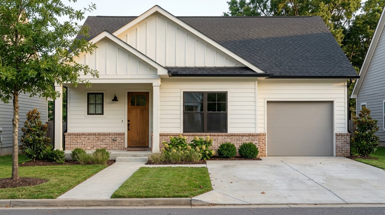
Buying waterfront property in Essex County can feel like a dream come true, but the view is only part of the story. If you are picturing a dock, a boat, or a future addition, the real questions start with the site itself. Understanding shoreline rules, flood exposure, access rights, and septic layout can help you avoid expensive surprises and buy with confidence. Let’s dive in.
Why Essex County waterfront needs extra homework
Essex County sits on Virginia’s Middle Peninsula and is bounded on the northeast by the Rappahannock River, with access to the Chesapeake Bay and its tributaries. That setting is a big part of the appeal, especially if you value boating, fishing, sailing, or simply being near the water.
But in Essex County, waterfront buying is often less about the view and more about what the lot can actually support. Two properties on the same river or creek can have very different rules, costs, and improvement options based on shoreline conditions, flood mapping, and recorded property rights.
Start with the shoreline type
A waterfront lot may look simple on a listing photo, but the shoreline classification can change what you can build, clear, or improve. Essex County’s Chesapeake Bay Preservation Area overlay includes tidal wetlands, certain nontidal wetlands, tidal shores, and a vegetated buffer of at least 100 feet.
The county also includes floodplains, highly erodible soils, highly permeable soils, and other sensitive land in its Resource Management Area. Just as important, the county says its overlay map is only a general guide. The actual Resource Protection Area boundary must be determined on each lot.
Why one river lot can differ from another
This is where buyers can get tripped up. A lot on the same body of water as a neighboring property may not have the same buildability, clearing allowances, or maintenance flexibility.
In Essex County, the tidal Rappahannock is considered a tidal water body. That means a property marketed as simple riverfront may still fall under tidal-water rules that affect permits and future plans.
Do not rely on GIS alone
Essex County’s GIS system is useful for parcel boundaries, parcel size, ownership, zoning, and flood mapping. It is a strong starting point, but the county is clear that it is not a survey.
For waterfront property, that distinction matters. A map pin or aerial image cannot confirm your exact access rights, the true lot lines, whether a dock easement exists, or who is responsible for a shared drive or private road.
Review the recorded documents
County land records can include deeds, easements, plats, covenants, and restrictions. Those records often tell the real story of a waterfront parcel.
Before you move forward, make sure you understand:
- Whether the deed includes direct water access
- Whether there is a dock easement or shared-use agreement
- Whether a private road serves the parcel
- Whether there are maintenance obligations tied to access
- Whether any recorded restrictions affect future improvements
Essex County’s subdivision rules also address private streets, easements, and public rights-of-way. In practical terms, you want to verify how the property legally reaches both the road and the water.
Check flood mapping early
Flood risk is one of the biggest budget and planning issues with waterfront property. Essex County’s floodplain permit application states that any activity or development in a floodplain district requires a zoning permit.
That application may require details such as base flood elevation, lowest floor elevation, and topographic information. This is why flood mapping should be part of your early due diligence, not something you review at the end.
Why flood zones affect more than insurance
FEMA’s Flood Map Service Center is the official source for flood hazard maps. If a property is in a Special Flood Hazard Area, National Flood Insurance Program requirements may apply, and lenders commonly require flood insurance for higher-risk zones.
That affects your monthly cost, but it can also affect future improvements. Essex County’s floodplain standards reference flood-resistant construction, anchoring, protected utilities, and sewage systems designed to reduce floodwater infiltration and contamination.
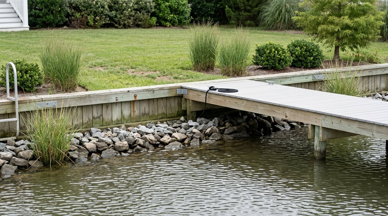
Ask about docks, bulkheads, and shoreline work
Many buyers assume an existing shoreline feature is automatically approved, or that adding a dock later will be simple. In reality, waterfront improvements can involve multiple layers of review.
In Virginia, VMRC oversees permitting for shoreline stabilization, pier construction, dredging, and certain work affecting dunes and beaches. DEQ’s Virginia Water Protection program regulates impacts to surface waters, including some clearing, filling, excavating, draining, or ditching in open water, streams, and wetlands.
Living shorelines matter in Virginia
Virginia law states that living shorelines are the preferred alternative for stabilizing tidal shorelines when a project qualifies. A living shoreline uses materials like plants, stone, sand fill, and other organic or structural elements to control erosion while maintaining coastal processes.
That does not mean every site will use the same solution, but it does mean you should not assume a traditional hard structure is your only option. If erosion control is part of your long-term plan, ask what permit path and shoreline approach may fit the property.
Verify the current permit path
Essex County’s Wetlands Board page says the county’s shoreline-permitting intake has changed and now directs applicants to the U.S. Army Corps of Engineers Regulatory Request System. The county also states that its wetlands and coastal sand dune ordinances were repealed.
The key takeaway is simple: do not budget for shoreline work based on old advice from a neighbor, seller, or outdated listing note. Confirm the current process before you buy.
Septic and well layout can shape your plans
In many parts of Essex County, onsite sewage and private wells are a major part of the equation. The Three Rivers Health District says municipal sewer and water serve only a small portion of the district, so private systems remain vital in the region.
For buyers, that means the septic system is not just a maintenance item. It is also a site-planning issue that can affect where you place additions, garages, patios, and even some driveway or access improvements.
Know what to locate before closing
Ask where the following are located on the property:
- Septic tank
- Drainfield
- Reserve area
- Private well
Virginia Department of Health regulations say no structures should be placed over the subsurface soil absorption system. Driveways and parking areas are also restricted unless certain conditions are met.
Permits and lifespan matter too
The Three Rivers Health District says construction permits for onsite systems are valid for 18 months and do not transfer with ownership, while certification letters do transfer. If a private well is part of the plan, it must be approved before an operation permit is issued.
VDH also says a typical septic system often lasts 30 to 40 years if properly maintained. Regular pumping and good drainfield care can make a big difference in long-term performance.
Watch for land-use tax consequences
If you are looking at a larger waterfront parcel, timbered tract, or land that could be divided later, ask whether the property is enrolled in Essex County’s land-use program. The county says qualifying land may be taxed based on use value rather than fair market value.
That can be beneficial, but changes can trigger costs. According to Essex County, a change in use, subdivision, rezoning, or a building permit can result in rollback taxes for up to five prior years plus interest.
Why this matters to waterfront buyers
This issue is especially important if you are buying with plans to build, split the parcel, or change how the land is used. A property that looks attractive from a tax standpoint today may carry a different cost once your plans move forward.
A smart Essex County waterfront checklist
Before you make an offer, try to answer these questions:
- Is the property on tidal water, near wetlands, or inside a Chesapeake Bay Preservation Area buffer?
- Has the site-specific protected-area boundary been identified?
- Is the parcel in a FEMA flood zone?
- Will flood insurance likely be required by your lender?
- Does the deed clearly include water access?
- Are there easements, shared-drive obligations, or private-road maintenance terms?
- Is there a documented permit history for a dock, bulkhead, riprap, boathouse, groin, or living shoreline?
- Where are the septic system, reserve area, and well located?
- If the land is in a land-use program, could your future plans trigger rollback taxes?
- Do you need a survey or recorded-document review to confirm what the listing suggests?
The bottom line on buying waterfront in Essex County
The best waterfront purchases usually happen when you treat the property like a site first and a view second. In Essex County, shoreline type, flood exposure, access rights, septic feasibility, and permit requirements can all shape what ownership looks like day to day.
That does not mean waterfront property is too complicated. It simply means the smartest buyers verify the details early, ask better questions, and build their budget around the real constraints and opportunities of the lot.
If you are thinking about buying waterfront property in Essex County and want practical guidance on the site, the records, and the questions to ask before you commit, connect with David Berberich.
FAQs
What should you check first before buying waterfront property in Essex County?
- Start with the site itself: shoreline type, flood mapping, recorded access, septic and well layout, and any permit history for shoreline improvements.
Does Essex County GIS confirm everything about a waterfront lot?
- No. Essex County says GIS is helpful for parcel and zoning information, but it is not a survey, so you still need to review recorded documents and often verify boundaries and access more carefully.
Can a riverfront property in Essex County still be treated as tidal waterfront?
- Yes. The tidal Rappahannock is a tidal water body, so a riverfront lot may be subject to tidal-water rules even if the listing makes it sound straightforward.
Why does flood mapping matter for Essex County waterfront homes?
- Flood mapping can affect permitting, construction standards, lender requirements, and flood insurance costs, which makes it a major due diligence item.
What improvements may need permits on Essex County waterfront property?
- Projects like docks, piers, dredging, shoreline stabilization, and some work in wetlands or surface waters may need review through VMRC, DEQ, or other applicable agencies.
How can septic layout affect your plans for an Essex County waterfront property?
- The septic tank, drainfield, reserve area, and well location can limit where you place additions, garages, patios, driveways, and other improvements.
Can land-use taxation create extra costs after buying Essex County waterfront land?
- Yes. If the parcel is enrolled in the county’s land-use program, a building permit, subdivision, rezoning, or change in use may trigger rollback taxes plus interest.